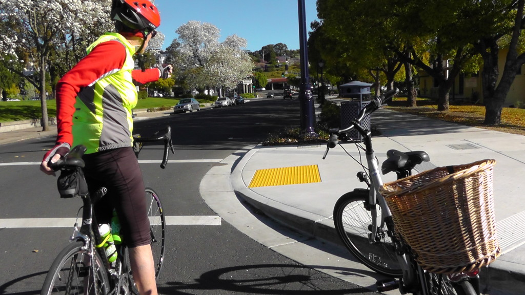
 With the recent warm and sunny weather, a small group of us were able to hit the Benicia streets to collect information about our city’s bicycle infrastructure. This is part of the work being done in conjunction with the Community Sustainability Commission’s 2014 work plan that includes developing a Benicia Bicycle Guide. As this is a volunteer effort, the scope and scale of the work being done is limited — but it’s a start.
Research indicates that bicycling brings both local and tourist dollars to a community. Wisconsin and Minnesota measure the economic impact of bicycles to their states in the hundreds of millions of dollars — and these are states with a limited cycling season. Having a bike-friendly community also increases real estate values. Naturally, bicycling in lieu of car transportation lowers greenhouse gas emissions and improves health as well. Even my latest edition of AARP describes a movement of “slow bicycling.” I’m sure it includes someone like me who bicycles both for transportation around town as well as the sheer joy of it.
Benician Nancy Lund, an avid bicyclist, member of the Benicia Bicycle Club and our city’s bicycle representative to the Solano Transit Authority, was asked to design a series of routes in Benicia. We wanted safe and easy routes to get from one side of Interstate 780 to the rest of town, a route that would highlight our public spaces like the library, community center, City Hall and the post office, our downtown shopping district, the Bay Trail and our historic points of interest. As someone who really knows the streets and hills of Benicia, Nancy did an outstanding job.
So, last week, we got on our bicycles with survey clipboards, cameras and maps and headed out on Nancy’s routes to gather information. We looked at things like street type, road surfaces, the environment, street lighting, places to lock or store bicycles, the amount of traffic and so on. Would anyone be surprised if I mentioned we had a lot of comments about the road surfaces?
What was really fun for me was learning some of the ways Nancy managed the steep hills around Southampton and Hastings. On an electric bicycle like mine, the hills aren’t a problem, but if you are on a bicycle and YOU are the engine, climbing Benicia hills are a problem. Hastings is a difficult street to climb on a bicycle. To manage it, Nancy mapped it to start from Southampton Road, turn up Hastings, left on Capitol, right on Cooper, right on Cambridge and left back onto Hastings. It’s a great way to avoid the steepest part of Hastings if you are heading in that direction.
The other fun aspect of these routes was getting to know the different neighborhoods and locations in Benicia. Having been a commuter (not by bike) to San Francisco and San Ramon, I really didn’t have the time on a weekend to get to know these manageable bicycle routes around town. It struck me that there may be a lot of people who are in the same situation who would like to know and use these routes, but who just don’t have the time to figure them out given their busy lives. Hopefully the Benicia Bicycle Guide will make navigating the city a lot easier.
Our final destination last Thursday was to continue our survey at the Benicia Historical Museum, where we happened upon Elizabeth d’Huart and Larry Lauber installing a new LED display case inside the museum. The LED lighting was funded through the Good Neighbor Steering Committee/Valero Settlement Agreement. Benicia is so loaded with bicycle-accessible historic locations that a visit to the museum with a pairing of bicycle destinations and historic information seems like a naturally interesting journey through our city’s rich history.
While we’re just starting to organize our findings and photos, we learned a lot about getting around town and things to highlight. For example, I didn’t know that the Military Cemetery in th Arsenal is only open Wednesdays, Saturdays and Sundays. People interested in military history would need that information to plan their visits, whether on bicycle or by car. Also, there is a trick to opening the new (and free) bicycle lockers on Military at K Street. (You need to move the handle to the right.)
In beginning this work, we’ve already made some great contacts. For example, we have figured out how to work with Google Maps to make these and other Benicia routes easily accessible via an Internet search. Naturally, the work isn’t done and we want to gather a lot of public input before we complete this project.
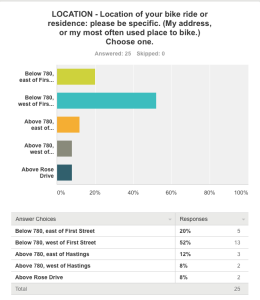
The other survey we’re doing, an attitude survey on “How Bikeable is Benicia,” has had a good start but we need more input. For example, the whole community above Interstate 780 is missing from the surveys submitted. So, if you own a bicycle and you live above 780, please take five to 10 minutes to complete the survey. You can link to it at BicycleBenicia.org. Look for the “Survey” tab and link using “Click here. I want to take the survey.”
The weather couldn’t be more ideal to get on a bicycle and ride around our great town. I hope to see you “Bicycling in Benicia.”
Learn more
• BicycleBenicia.org — find the “Survey” tab and “Click here. I want to take the survey”
• beniciabicycleclub.org — check out their ride ratings at beniciabicycleclub.org/ride-library/
• Safe Routes to School — Benicia: http://www.solanosr2s.ca.gov/app_pages/view/4529
Constance Beutel is a the chair of Benicia’s Community Sustainability Commission. She is a university professor and videographer and holds a doctorate from the University of San Francisco.


Why don’t bicycles have to stop at stop signs?